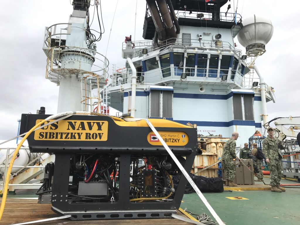
When the water goes dark or dirty, imaging sonar is how you keep finding a return; a camera is how you identify what that return is once you can put light across a short, clear path. Sonar stops being enough the moment the job needs a fine defect confirmed by eye. This guide separates a simple depth ping from an imaging-sonar picture, and it does not claim that a sound picture replaces a close visual look.
Quick answer box
- Right for this job: Imaging sonar (for example the Cerulean Omniscan 450 FS listed at a 120 m maximum range) when the camera has no usable picture and you still need to detect and approach a target; a camera with lights when you must identify what you found. (Blue Robotics Omniscan product page and BlueROV2 buyers guide, opened September 29, 2026.)
- Wrong for this job: Treating a single-beam depth ping as an inspection image, or treating any sonar image as proof of a fine crack, coating failure, or weld defect without a close visual pass.
- The number that decides it: 120 meters—the Omniscan 450 FS maximum range printed on the Blue Robotics store page—versus the fact that a BlueROV2 camera still needs light and clear enough water to form an optical picture. (Omniscan product page; BlueROV2 store and buyers guide, September 29, 2026.)
- What the spec leaves out: Maker pages state acoustic range, beam geometry, and that lights illuminate dark places; they do not hand you a pass/fail for a hairline crack on a hull from the sound picture alone.
- Check before you rely on it: Open the live product page for whether it describes a single-beam distance or an image, note the stated range, and ask whether your recording includes subject, distance, and a way to find the same place again.
- Last checked (September 29, 2026)
What the transducer and the camera actually return
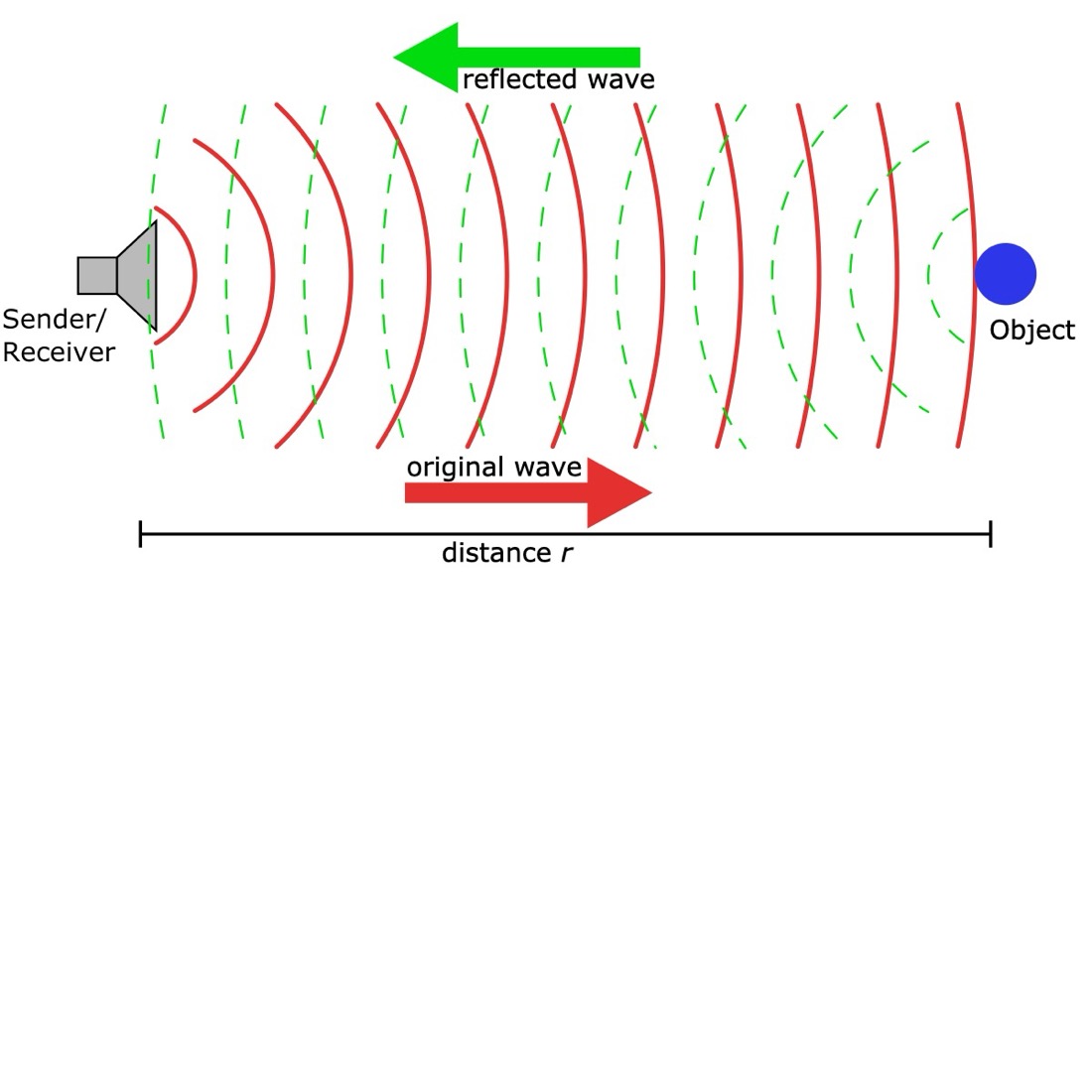
NOAA’s Ocean Service page on sonar states the core idea plainly: sound waves travel farther in water than light waves, which is why sonar is useful for exploring and mapping when optical methods fall short. Active sonar, on that same page, sends a pulse from a transducer; if something sits in the path, an echo returns, and timing that round trip gives range and orientation. That is the physics under both a simple depth ping and an imaging sonar. It is not the same thing as a camera recording light through water and a dome.
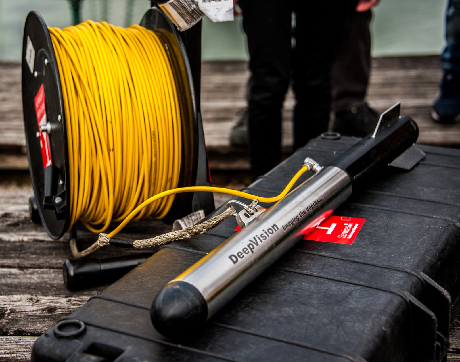
Blue Robotics’ Ping Sonar Altimeter and Echosounder is the clear example of a depth ping. The store page calls it a single-beam echosounder that measures distances up to 100 meters underwater. It uses a 115 kHz transducer frequency, a 25-degree beamwidth, and a 300 meter depth rating for the housing. The product description walks through the mechanism: a piezoelectric transducer sends an ultrasonic pulse, then listens for echoes, and reports the distance to the strongest return—usually the seafloor or a large object. It can also output the full echo response plotted much like a fish-finder display. That plot is still a range profile along one beam. It is not a painted acoustic image of a wreck wall or a hull plate.
The Ping Sonar technical guide on the same site spells out the distance equation: known speed of sound in water times half the measured echo travel time. It also notes profile samples—200 signal-strength measurements across the range window. Even with that profile, the job is distance and echo strength along the beam, not a navigable sound picture of an inspection target.
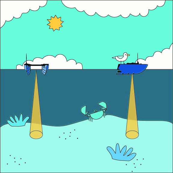

Imaging sonar is a different product class on the same shelf. The Cerulean Omniscan 450 FS page on Blue Robotics describes an imaging sonar with a maximum range of 120 meters, a transducer frequency of 450 kHz, a beam height of 50 degrees, and a nominal beam width of 0.8 degrees. Range resolution is listed as up to 1/1200 of the range setting. The page states that SonarView “paints” the image in real time as the ROV moves, instead of waiting on a slow mechanical scanner sweep. The buyers guide lists the same Omniscan as “Imaging sonar with long 120 meter range” and says it builds an image dynamically as the ROV moves. That 120 meter figure appears on both pages we opened on September 29, 2026.
The same buyers guide separates roles cleanly: the Ping Sonar “determines the distance to the seafloor,” while imaging options (including the Omniscan, a Ping360 scanning imaging sonar, and a Sonoptix ECHO multibeam imaging sonar) exist for navigation and locating objects when visibility is poor. The Sonoptix line on that guide even states that multibeam imaging can create real-time images “even in zero visibility.” That is a claim about acoustic imaging in water that will not pass a camera picture—not a claim that the sound picture finishes a defect call.
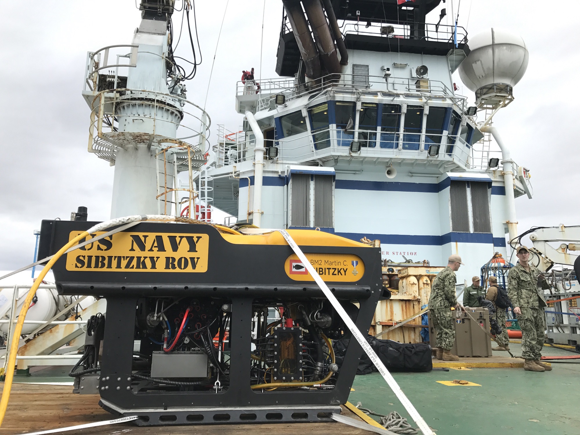
The camera side of the same vehicle is optical. The BlueROV2 store page describes a forward-facing low-light HD USB camera at 1080p and 30 fps inside the electronics enclosure, with light sensitivity listed at 0.01 lux, and notes the ROV can carry two or four dimmable Lumen lights providing up to 6,000 lumens (1,500 lumens each in the specification table). The buyers guide is blunt: lights illuminate dark places; options include no lights, two lights, or four lights; and for visual inspections a camera is the basic sensor, but “good lighting is also important.” Housing depth ratings—100 meters on the Omniscan page for that sonar, 300 meters on the Ping page for that echosounder, and separate depth ratings for lights and cameras on the vehicle page—tell you how deep the hardware may go. They do not tell you how far either sensor can identify a crack.

When the job picks the sensor you trust
Trust follows the failure mode of the sensor you already know. The case titled “How to choose an underwater camera when the water is murky” fails when the water will not pass light. Lights on a BlueROV2 can throw thousands of lumens, but lumen output does not create clarity. Suspended sediment and darkness starve the camera of a usable picture. NOAA’s statement that sound travels farther than light is why crews reach for acoustics then—not because sonar becomes a microscope for coatings and welds.
A depth ping earns trust when the question is distance: altitude above the seabed, range to a wall, a number for terrain following or obstacle avoidance. The Ping product page lists those jobs explicitly—altimeter for ROVs and AUVs, bathymetry on a USV, obstacle avoidance, other underwater distance measurement. If your dive plan only needs “how far is the bottom,” a single-beam return is the right tool. If your dive plan needs “where is the object and what shape does the return paint,” you need imaging sonar, not a stronger belief in the ping waterfall.
Imaging sonar earns trust when you must detect and navigate to a target beyond what the camera can show. The Omniscan page says a 120 meter range lets you detect targets far beyond the ROV’s reach and that a 50 degree vertical beamwidth helps you see objects far below the vehicle. The buyers guide pairs poor visibility with imaging sonars that help locate the objects you will inspect. Locate is the verb that matters. Identify is the camera’s verb once you close the distance and the water between the dome and the subject clears enough for light to work.
A boat fish-finder screenshot is not this imaging-sonar inspection picture, and it is not a hydrographic chart. NOAA’s sonar fact page describes sonar for nautical charts, hazards, wreck search, and seafloor mapping—a different path from an ROV pilot painting returns toward a discrete inspection target. Read next, as plain text unless a live post is confirmed: How a boat’s sonar differs from an ROV camera and from imaging sonar. This article does not write that seabed-map story.


What you can verify on the pages yourself
Open these URLs yourself. Each was opened for this article on September 29, 2026:
- https://bluerobotics.com/store/sonars/echosounders/ping-sonar-r2-rp/ — Look for “single beam echosounder,” typical usable range 100 m, frequency 115 kHz, and language about distance to the strongest echo. That page is a range tool, not an imaging-sonar brochure.
- https://bluerobotics.com/learn/ping-sonar-technical-guide/ — Confirm the pulse-and-echo operating principle and the distance equation. Note profile output versus a painted scene.
- https://bluerobotics.com/store/sonars/imaging-sonars/cerulean-omniscan-450-fs-imaging-sonar/ — Confirm “imaging sonar,” maximum range 120 m, 450 kHz, and that SonarView paints an image as the vehicle moves. The page markets locating and navigating to seafloor targets; it does not publish a crack-width acceptance table.
- https://bluerobotics.com/learn/bluerov2-buyers-guide/ — Confirm the 120 meter Omniscan label, the Ping-as-altimeter line, the imaging-sonar list for poor visibility, and the lights-and-camera guidance for visual work.
- https://bluerobotics.com/store/rov/bluerov2/ — Confirm the low-light camera and that the vehicle can carry Lumen lights. A camera still needs light; carrying lights does not invent water clarity.
- https://oceanservice.noaa.gov/facts/sonar.html — Confirm that sound travels farther than light and that active sonar times an echo for range.
USACE pages on acoustic cameras for turbid-structure work were attempted for this article on the same date and did not load in our environment; no USACE measurement or class-survey rule is cited here.
A useful recording—optical or acoustic—has a subject, a distance or range setting, and a way to find the same place again. A sonar clip with no position is weak evidence even when the returns look dramatic. The Omniscan page’s range-resolution line (up to 1/1200 of the range setting) is a maker statement about how finely range bins can split along the beam; it is not a license to call coating failure from the mosaic alone.
Decide before the vehicle enters the water
If the water is too dirty or too dark for a camera, plan imaging sonar to find the target, then move in for a camera pass if the object must be identified. That sequence matches what the buyers guide already implies: imaging sonars help locate objects you will inspect, and visual inspection still rests on a camera with lighting appropriate to the scene. If a page never states range or resolution, write “not stated” in your own notes and do not borrow a number from a review site. For this article, Omniscan maximum range is stated as 120 m on the product page; Ping typical usable range is stated as 100 m on its product page. Anything those pages leave blank stays blank here.
Lights off versus sonar on is an operator choice driven by the picture you need, power budget, and clutter in the water. The BlueROV2 pages state battery life for normal and light use of the vehicle, but they do not publish a controlled test of “minutes of battery spent with lights off and sonar on” for this decision. Do not invent that number. Turn lights on when you close for identification; keep acoustic search on when the optical path is empty.
Depth rating of a housing is a go/no-go for pressure, not a decision about which sensor tells the truth about a defect. An Omniscan rated to 100 meters can still only return sound. A camera behind acrylic can still only return light. Choose the sensor for the question—distance, detection in the dark, or visual identification—before the dive clock starts.
One sourced distinction that settles the vocabulary
Blue Robotics’ Ping store page states that a single-beam echosounder determines distance to the strongest echo and can plot echo strength versus time like a fish finder. The Omniscan 450 FS store page states a maximum range of 120 meters and that Cerulean’s SonarView paints an image in real time as the ROV moves. Those two sentences, both opened on September 29, 2026, are enough to keep the tools apart: one range (or a range profile), versus a picture built from many returns. Do not call the Ping waterfall an imaging-sonar inspection mosaic, and do not treat the Omniscan mosaic as a close visual certificate.
The mistake that turns a useful picture into a bad call
The harmful mistake is treating a sonar image as proof of a fine defect, or skipping the close visual look because the sound picture already “showed the hull.” A sound picture can show that something large is there, that a shape is continuous or broken at the scale the beam and range setting can resolve, and that you have closed enough to put a camera on it. It does not, on the pages we opened, confirm a fine crack, coating failure, or weld defect the way a close visual pass can. Maker resolution lines describe acoustic bins, not dye-penetrant results. NOAA’s page explains why sound finds objects when light cannot; it does not turn an echo into a coating survey.
So the operational rule stays conservative and sourced to the roles the makers actually print: use imaging sonar to find the return in dark or dirty water, then put a camera close enough—with light and a short clear path—to identify what you found. This article does not claim sonar replaces that close look.
Read next: How to choose an underwater camera when the water is murky; How a boat’s sonar differs from an ROV camera and from imaging sonar.